Places that we planned to visit
I sent this to SaraGrace some 18 months prior to our departure as a way to "sell" her on the trip (We had just started dating).
[I have no idea where I got the photos from. I have replaced most of them with ones that we took on our trip; - my apologies if I stole any of the remaining from you. As for the text - most is paraphrased from various unremembered places (complete with bad English); again if you see text you wrote, apologies for the plagiarism. In either case, drop me a note and I will remove the offensive material.]
Places that I am going to visit with my wonderful girlfriend, SaraGrace
Tikal
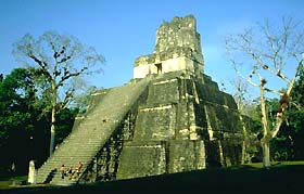
Living in and amongst these trees are troops of spider monkeys, 285 species of birds, 209 of which are resident species: including hawks, hummingbirds, parrots, and golden turkeys. Outside of the ruins live jaguar, puma, ocelot, pecarry, small deer, and many other animals, many rare and endangered.
Tikal was a prime city of the Maya. At least 10,000 people lived within the mapped portion of the city, which encompasses six square miles. The maps reveal 3000 separate constructions, including temples, palaces, shrines, ceremonial platforms,
residences, ball courts, terraces, causeways, and plazas. In the main ceremonial precincts there are 200 stone monuments, known as stelae. Stelae were elaborately carved with glyphs, a form of writing, and other images.
Angel Falls
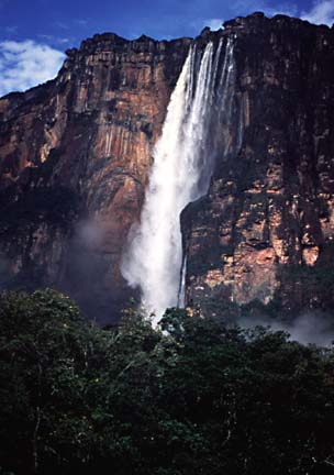
The water that leaves the summit takes fourteen seconds to reach the bottom, although in the dry season much of that water is blown away in a fine mist. Although the local Indians had known of its existence for thousands of years, and Sir Walter Raleigh had probably heard of it, the earliest recorded sighting by a white man was in 1910, by Venezuelan explorer Ernesto Sánchez La Cruz. However the name comes from the American bush-pilot Jimmy Angel, who first flew over the area in 1921. He flew in from Panama, where he had been hired by an old prospector (for $5,000) to fly to and land on the summit of Auyán-tepui, where they allegedly found a stream, and panned considerable quantities of gold. The prospector, having sold his haul for $27,000, subsequently died, and it was not until 1935 that Angel returned, and found the falls that now bear his name. Two years later, in 1937, he attempted a landing, but despite a successful touchdown the aircraft (the Rio Caroní) nose-dived when it hit soft ground at the end of its landing run and Angel, his wife Marie and his companions (Gustavo Heny and his gardener!) had to walk out.
Luckily Heny had previously climbed the tepui, and so was able to guide the party down the south flank, a trip that took them 11 days. The plane remained there until 1970, when it was taken out by helicopter and can be seen today outside the airport terminal at Ciudad Bolívar.
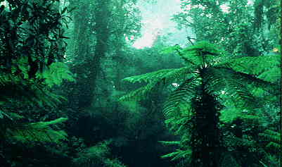
The Amazon
Titicaca
Nestled next to the Royal Mountain Range on the East and northern end of Bolivia's Altiplano, Lago Titicaca's deep sapphire-blue waters shimmer with life and provide a surreal contrast to the surrounding landscape typical of the Altiplano
Machu Pichu
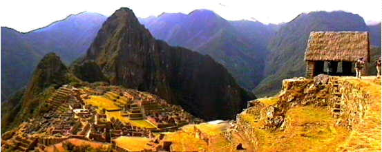
A visit to the ancient Inca city of Machu Picchu is a highlight of any trip to Peru. These ruins were discovered in 1911 by Hiram Bingham while he was searching for Vilcabamba, the last refuge of the Inca kings. Today it is generally understood that Machu Picchu was instead a religious center which remained hidden from the depredations of the Spaniards.
Machu Picchu is approachable from Cuzco by a modern train built to transport tourists there, or by the original Inca Trail, a 5 day hike. The train brings in hundreds of tourists from mid morning on and leaves in the late afternoon. A modern hotel at the site hosts people fortunate enough to stay overnight - and they have the ruins virtually to themselves when the hoards of tourists have left.
The city is perched on the top of a mountain and has terraces trailing down the slopes on both sides. The Urubamba River winds around the mountain, and is visible thousands of feet below, circling the city. Rising steeply above Machu Picchu is Huayna Picchu, a mountain with ruins visible on top of it as well.
Nazca
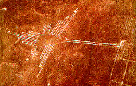
Scientists and historians immediately look into the issue. However, it is not until 1939 that Paul Kosok, an American archaeologist, comes to carry out the first systematic samples of these figures. They showed to be arranged in three distinct groups : straight, zigzagged, or spiral lines, geometric figures, and representations of people and animals. All these figures, among which there are some that are more than 135 yards long, cross the landscape as if they were not there.
The most incredible thing about these figures, which spread out across about 400 square yards, is that they can only be seen from the sky. How did the Nazcans, who lived more than five centuries before our era, used to draw them? Maria Reich, who, since 1945, dedicates her life to the upkeep and the study of the Nazca figures, claims that the Nazcan Indians worked from sketches that they enlarged. This was the only hypothesis until an American adventurer of the name Jim Woodman discovers, on Nazca pottery, drawings of balloons with a nacelle in the shape of a gondola.
Does that mean that almost 2000 years ago before the historic beginning of the aerial adventure, the Nazcans had invented the precursor of the airship? This would have allowed them to visualize the line of all these figures, whose meaning still remains a disturbing enigma today.
Maria Reich's hypothesis, which states that the straight lines form an astronomical calendar which allows dates and seasons to be calculated, does not stand up to the study carried on computer in 1968 by Gerald Hawkins.
Simone and Jack Waisbard, respectively ethnologist and computer scientist, had the idea to study all the drawings together as a homogeneous entity rather than study each figure separately. They noticed that even though they are situated and oriented in a very precise manner in relation to each other, so as to form meteorological calendar rather than an astronomical one, helps to know and foresee the rhythm of the seasons.
For Tony Morisson, English explorer and movie maker, there is a religious meaning to the lines : The lines are sacred paths linking altars and the drawings of the illustrations of their gods.
As for Erich von Daniken, Swiss author of Chariots of the Gods
Victoria Falls
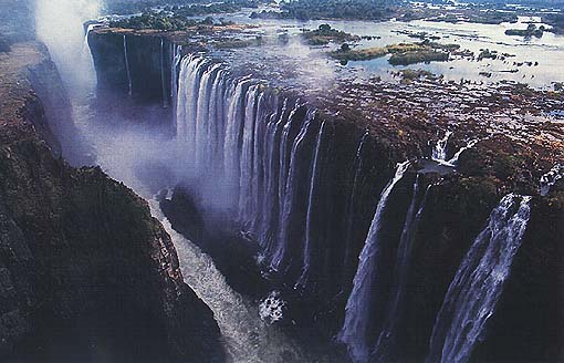
The most intimate contact you’ll make with the Falls is in the older part of town and in the earliest houses. Here, in the flood, in the deep hours of the night, you might be woken by the faint tinkling of a teaspoon left inadvertently in an empty glass, or the rattle of a loose window pane. Do not be alarmed. It is the great raft of rock on which the town is built vibrating to the triumphant song of the Zambezi as it thunders and tumbles over the Falls on its journey to the sea.
David Livingstone did not, of course, "discover" Victoria Falls. They had been in place for millions of years and were well-known to mankind for as long as he had lived in the region. What Livingstone did was to report the existence of the Falls to the outside world. The result was immediate.
On the 3rd of August, 1860, the second white visitor to the Falls, William Baldwin, arrived - just a day before David Livingstone’s return to England. From that point, the number of foreign visitors rose steadily. By the turn of the century many hundreds of Victorians had made the pilgrimage, along with their wives and children, and accompanied by a bevy of servants.
People walked, rode on horseback or traveled by ox-wagon from the Transvaal along what was then called the Hunter's Road (now the border between Botswana and Zimbabwe). Upon reaching George Westbeech’s store at Pandamatenga they left their animals, safe from the lethal bite of the tsetse fly, and walked the remaining 80 kilometers due north to the Falls.
Kilmanjaro
Zanzibar

The ancient Stone Town, steeped in history and bustling bazaar activity, with its narrow streets and haunting Arab architecture, each house with its unique carved door and lintel, is a delightful area to get lost in.
When in Stone Town why not visit the Mbweni Ruins hotel, or experience the old world feel of the Dhow Palace or Tembo hotels.
Finally take a Dhow trip to the south of the island to visit and swim with Dolphins with Adventure Afloat, stopping en route at deserted sandbanks for snorkeling and lunch.
The Serengeti
Giza
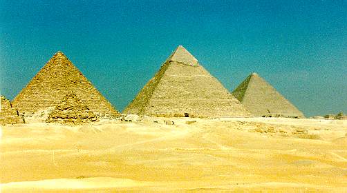
Cheops' pyramid is the highest of the three, although an optical illusion makes it look smaller than Chephren's. The wind erosion has reduced the original height of 146 meters by nine meters. Its base is 230 meters. The pyramid is constructed from 2 - 3 tons heavy limestone blocks, each and every one of them properly put together.
St. Basil's Cathedral
Lake Baikal
Great Wall of China
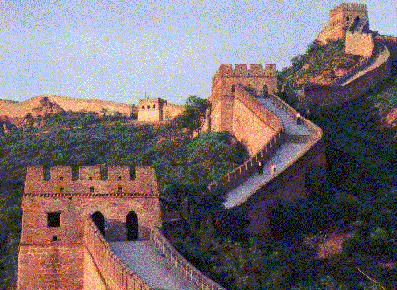
Clay bricks molded and cooked in a kiln were used to build The Great Wall by being stacked one on top of the other.
The Great Wall of China zigzags across the Yen mountains from Shanhai Guan (off the coast of Beijing) to the Gansu province. It stretches over three provinces for over nearly 6400 kilometers making it the largest man-made structure in the world.
Displaying to the traveler an endlessly long view The Great Wall once stretched over 6,000 miles but now erosion and vandalism have reduced it to 3,750 miles. The Great Wall's height averages from 15 to 30 feet high it's width averages from 15 to 25 feet wide with about a 13 foot wide roadway on top.
The most visited part of the wall is Beijing. The government is now restoring parts of the wall here and in other places.
The Great Wall of China was built by stacking mud or clay bricks one by one on top of each other. The brick, was first produced in a sun - dried form at least 6,000 years ago, and is the forerunner of a wide range of of clay building products used today. It is the small building unit in the form of a rectangular block, formed from clay, shale , or other mixtures and burned {fired} in a kiln, or oven, to produce strength, hardness, and heat resistance. The original concept of ancient brick makers was that
the unit should not be bigger than what one man could easily handle. Today, brick size varies from country to country, and every nation's brick making industry produces a range of sizes that may run well into the hundreds.
From Shaikwan on the the gulf of Liao Tuna to the Hwang Ho, Chin Shih Hwang Ti's Great Wall followed the highlands of the southern rim of the Mongolian basin and thus had some physical justification. However in it's continuation westward along the north bank of the Hwang Ho. The Wall ceases to conform to a natural region. For it crosses the 15 inch isohyet and embraces a large area of sparce and variable rainfall. The Ordos which is far more suited to pastoral economy than intensive agriculture thus in disregarding geographical factors and attempting to include permanently within his domains, essentially pastoral lands. Chin Shih Hwang Ti defeated his own ends and the main purpose of the wall, i.e. the separation of these two economies. Often there were large numbers of nomads living within The Great Wall while it was sited so far north. Nineteen Hsiung-Nu tribes occurred at the Ordos region at the time of the three kingdoms (ad 220-265). While the Han emperors remained powerful and energetic they were able to keep the northern pastoralists
under control but immediately there was a weakening of imperial power. The old forces reasserted themselves and the struggle between the two ways of life was renewed. Chin Shih Hwang Ti's wall to the north of the Ordos was eventually abandoned and one to the south conforming closely to the 15 inch isohyet was built.
The Great Wall of China has done it's job well separating these two areas as well as protect that part of China from being attacked.
Everest
Taj Mahal
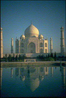
Even though built at the cost of much human life, the white marbled mausoleum at Agra has become the monument of a man's love for a woman.
In 1631, when his wife died in childbirth, the emperor Shah Jihan brought to Agra the most skilled craftsmen from all Asia and even Europe. He intended to build a black marbled mausoleum for himself and the link between the two was to be a silver bridge.
But the enemy of mortality stopped this breathtakingly beautiful conception.
Everyone has their own favorite time to see the Taj Mahal. Crowds will distract you from the coolly serene presence of this flawless monument. Try arriving just as it opens or is about to close. A few minutes alone in the perpetually echoing inner
sanctum will reward you far more than several hours spent on a guided tour. The sensuously curving lines of the temple of love demand to be savored without interruption, then the presence of the building itself will impart its own message.
The tombs of Shah Jahan and his wife Mumtaz Mahal are actually located in a shadowy burial crypt. At ground level, in the very centre of the building is the cenotaph dedicated to Mumtaz. Sing in the inner shrine and the notes will float upwards in a presentiment of the music of the spheres.
Relax and be open. Under the full moon the pearly white exterior is shrouded in mystery. Love, the greatest mystery of all. In India, part at least of your time will be spent learning and gaining new perspectives. That lasts.
Angkor Wat
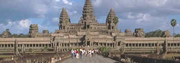
The temple ground is surrounded by a wall and a moat, not only for demarcation purposes, but also because in Hindu mythology Mount Meru is surrounded by other mountain ranges and oceans.
The main entryway to Angkor Wat is a street of roughly half a kilometer length, ornamented with balustrades and fringed by artificial lakes, so-called Barays. This entryway resembles the rainbow bridge in Hindu mythology, the link between heaven and earth, or the realm of the gods and the realm of the mortals.
Angkor Wat is in better structural condition than many other temples on the Angkor plain because it has been converted into a Buddhist temple probably even before the Siamese conquest in 1431, and because it has been used as such continuously after (in the 13th century Buddhism became an important religion in originally pure-Hindu Angkor).
 MRA
MRA SGK
SGK Michelangelo
 Isabella


No comments:
Post a Comment